Quebrada del Condorito National Park
Located in the west of Córdoba province, in the heart of the Sierras Grandes, Parque Nacional Quebrada del Condorito is one of the most singular ecosystems in Argentina. This protected area, covering some 37,344 hectares, sits on a geological formation of great age, with structures composed of hardened magma from approximately 700 million years ago. Its significance lies in its function as a biogeographic island at altitude; situated in a transition zone between various ecoregions, the park hosts a biodiversity that combines traits of the Chaco Seco with elements typical of Andean-Patagonian environments.
Landscape and high-altitude biodiversity
The park’s terrain is defined by deep ravines, such as those of the quebradas del Condorito, Batán, del Sur, Corralero and Yatán, which can reach depths of more than 400 metres. The structure of the Pampa de Achala — a flat elevated plain with very little slope, lying between 1,900 and 2,300 metres above sea level — allows for soil formation and a complex drainage network that gives rise to important hydrological basins. In this setting, it is possible to observe high-altitude grasslands and isolated groves of tabaquillo, vegetation that evokes the landscapes of north-western Argentina.
The fauna is one of the most distinctive features of the area. The park takes its name from the Andean Condor, whose vertical walls of around 300 metres serve as roosts for this species. The area also functions as an active conservation space; for example, populations of guanacos reintroduced into the park’s intangible zone are monitored using radio-telemetry technology. The presence of these species and the protection of water sources consolidate the site as a vital reserve for regional ecological balance.
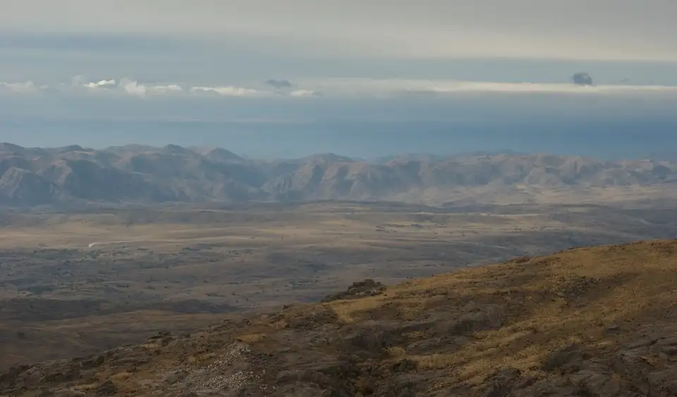
The Sierras Grandes setting
The park’s climate is cold-temperate mountain, characterised by a wide temperature range. In summer, average temperatures are around 14.5 °C, while in winter they can drop to -20 °C. Annual rainfall reaches 900 mm, concentrated mainly in the summer season. This climatic dynamic, combined with the presence of snow and ice in the coldest months, defines a high-mountain environment where weather conditions can change rapidly.
The park forms part of a larger protection system surrounding the national reserve zone. Around its boundaries extend 145,000 hectares of provincial reserve that complete the biological corridor, connecting protected areas such as Los Gigantes to the north and Cerro Champaquí to the south. This territorial continuity is fundamental for preserving natural processes and regulating water runoff, as the natural vegetation cover protects the soils and ensures the flow of rivers that rise from these high summits.